Jump to ratings and reviews
Rate this book

Railway Maps of the World

Rate this book
A gorgeously illustrated collection of the world's greatest railway maps and posters, historical and contemporary.

Transit Maps of the World was an extraordinary and unexpected success and is now a cult favorite. In his irresistible follow-up Mark Ovenden has produced a mesmerizing compendium of historical and contemporary railway maps and posters from every corner of the world. Hundreds of images, covering two centuries of railway advertising, surveyors' plans, travel posters, satellite photos, and station wall maps, are combined with text brimming with vivid historical details and charming anecdotes.

Part One presents the stunning visual material chronologically, from the Liverpool and Manchester Railway of 1830 to the proposed 2020 high speed networks of China. Part Two is an atlas of maps from more than one hundred countries from Algeria to Argentina to Zambia and Zimbabwe. Appendixes include a trove of factoids, track stats and information about rail operators and rail museums. Railway Maps of the World is a visual delight for your eyes, making it a must have for every train fanatic-armchair or ticketed-history buff, and lover of graphic design.

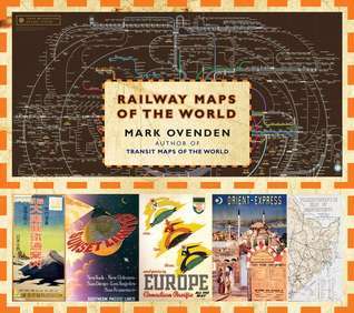
144 pages, Hardcover

First published April 28, 2011

3 people are currently reading
207 people want to read

About the author

Mark Ovenden

11 books15 followers
Mark Ovenden is a British writer and broadcaster whose previous books include Transit Maps of the World and Paris Underground: The Maps, Stations and Designs of the Metro. He lives in Paris, France."

Ratings & Reviews

What do you think?
Rate this book

Friends & Following

Create a free account to discover what your friends think of this book!

Community Reviews

5 stars
26 (30%)
4 stars
27 (31%)
3 stars
26 (30%)
2 stars
6 (7%)
1 star
0 (0%)
Displaying 1 - 12 of 12 reviews
223 reviews24 followers
January 15, 2019
My maternal grandfather was born in 1886, never learned to drive, and did not own a car until he was nearly 60 years old. Until that time every trip of more than 25 miles he had taken during his life had been by train. At one time I am sure he was familiar with every railroad line in Ohio. His last trip was in 1970 when he and my grandmother traveled from their home in central Ohio to visit my mother at our home near Richmond, VA, within sight of the Richmond-Danville rail line, the one Virgil Kane drove on until "so much cavalry came and tore up the tracks again".

My grandfather lived long enough to realize that the days of passenger rail service, at least in the US, were unlikely to return to the status they enjoyed in his youth. I suspect that he found this depressing and, I suspect, Mark Ovenden does also. There is relatively little text in this book and much of it addresses the decline in passenger railroad mileage as shown in this impressive collection of maps.

My only problem with this book is that the reproductions are so small that even with my 2.75 magnification reading glasses, I could not read most of them.
Profile Image for William Nist.
361 reviews11 followers
March 14, 2015
It is a shame that this beautiful book is simply too small in size. It is a book of maps but many if not most can not be read even with a magnifying glass. The volume has to be at least 50% larger. This is a publishers decision probably.

The first half of the book contains some short descriptions of some rail history and issues, and the second half of the book is an atlas of rail maps from all over the world.
320 reviews
November 8, 2017
Interesting, but a seemingly random selection of railroad maps. Tries to categorize them, but not done well. OK for a coffee table book.
1,260 reviews
February 23, 2019
Interesting and informational. Only complaint is many of them are so small you can't read them to find locations etc.
Profile Image for Fariha.
429 reviews8 followers
September 9, 2018
Absolutely wonderful book, with beautiful illustrations and pictures of maps and posters throughout. This book is every cartography fan and every railway fan's dream come true (so of course I was ecstatic). With the aid of the pictures, this book manages to take you through the history, including the conception, rise, and development of railways all over the world, and their subsequent effects on people, the land, economy, etc. And all this without being a 10 billion word essay. It's just sheer genius.

\Just to give you a feel, the contents page is thus:

CHAPTERS:
THE RAILWORLD
RAIL CARTOGRAPHY
MERE MARKETING OR PURE PROPAGANDA?
WESTERN DECLINE AND EASTERN PROMISE
THE WORLD'S GREATEST RAIL ROUTES

ATLAS OF WORLD RAILWAYS:
AFRICA
THE AMERICAS
ASIA
EUROPE
OCEANIA

I mean that's one of the greatest contents pages I've ever seen.

Profile Image for Angel .
1,522 reviews46 followers
September 28, 2011
The strength of this book lies in the photos and poster reproductions. If you are a visual person, you will enjoy this book. If you are like me, and you enjoy looking at old time vintage images, then you will like the book as well. Most of the text is pretty interesting, especially, the first part of the book that contains the historical things. However, text is often pretty small (the font they chose), making it a little hard to read. Overall, this is a book to browse and enjoy for the visual appeal. Railroad buffs will very likely enjoy it.
Profile Image for Mark Schlatter.
1,253 reviews15 followers
September 5, 2011
I like the concept more than the execution. The history is interesting, and the maps look beautiful, but the connection between the two just isn't tightly integrated. Moreover, the tiny size of many of the maps made it hard for this near-sighted reader to fully appreciate the work. I would like to know if the transit map book is better.
Profile Image for Nick Jones.
146 reviews3 followers
June 8, 2012
Pretty cool. Got it as a gift for my brother, and read it before I gave it away. The maps are great but the pages are too small: I had to peer really closely at the pages with glasses off (near-sighted) to figure them out.
12 reviews2 followers
January 7, 2017
Lots of content, but the maps, especially the historical ones, while well reproduced were too fiddly too see the detail. I longed for zoomable PDFs or Google Maps overlays, but I guess that's not really what you can expect from a book.
Profile Image for Ben.
882 reviews17 followers
August 24, 2011
An impressive and informative collection, with both historical and modern examples. Some are ho-hum, but many are unique in design and almost all of them have their own sort of beauty.
Profile Image for Kris McCracken.
1,846 reviews57 followers
August 9, 2013
If you like history and you like maps, you're bound to like this lovely coffee table book. B.
Displaying 1 - 12 of 12 reviews

Can't find what you're looking for?

Get help and learn more about the design.