Jump to ratings and reviews
Rate this book

On the Map: A Mind-Expanding Exploration of the Way the World Looks

Rate this book
Cartography enthusiasts rejoice: the bestselling author of the Just My Type reveals the fascinating relationship between man and map.

Simon Garfield’s Just My Type illuminated the world of fonts and made everyone take a stand on Comic Sans and care about kerning. Now Garfield takes on a subject even dearer to our fanatical human hearts: maps.

Imagine a world without maps. How would we travel? Could we own land? What would men and women argue about in cars? Scientists have even suggested that mapping—not language—is what elevated our prehistoric ancestors from ape-dom. Follow the history of maps from the early explorers’ maps and the awe-inspiring medieval Mappa Mundi to Google Maps and the satellite renderings on our smartphones, Garfield explores the unique way that maps relate and realign our history—and reflect the best and worst of what makes us human.

Featuring a foreword by Dava Sobel and packed with fascinating tales of cartographic intrigue, outsize personalities, and amusing “pocket maps” on an array of subjects from how to fold a map to the strangest maps on the Internet, On the Map is a rich historical tapestry infused with Garfield’s signature narrative flair. Map-obsessives and everyone who loved Just My Type will be lining up to join Garfield on his audacious journey through time and around the globe.

464 pages, Hardcover

First published December 27, 2012

368 people are currently reading
10384 people want to read

About the author

Simon Garfield

36 books331 followers
Simon Garfield is a British journalist and non-fiction author. He was educated at the independent University College School in Hampstead, London, and the London School of Economics, where he was the Executive Editor of The Beaver. He also regularly writes for The Observer newspaper.

Ratings & Reviews

What do you think?
Rate this book

Friends & Following

Create a free account to discover what your friends think of this book!

Community Reviews

5 stars
831 (18%)
4 stars
1,843 (41%)
3 stars
1,379 (31%)
2 stars
314 (7%)
1 star
61 (1%)
Displaying 1 - 30 of 571 reviews
Profile Image for Warwick.
Author 1 book15.3k followers
November 22, 2014

Amiable, intermittently fascinating and too comprehensive for its own good – On the Map is all over the map. When it's good, it's very good, at least if you're a chartophile like me, and it offers a rich storehouse of anecdotes on everything and everyone from Ptolemy to Skyrim. But as a single narrative it never really hangs together.

Did I know, before I read this, that the concept of ‘orienting’ oneself comes from the fact that medieval maps had east at the top? If I did, I'd forgotten it. And it's always fun to read about the kind of peoples that populated those early maps, not just dragons and sea monsters but exotic cryptozoologica from the Classical world like the sciapods (‘A mythical race of people supposed to have lived at the southern edge of the ancient Greek and Roman world, who each had a single leg ending in a foot of immense size with which they shaded themselves from the heat of the sun’ – OED).

Other oddities survived to the modern era. The Mountains of Kong first appeared on James Rennell's map of Africa in 1798 and were still being charted into the early twentieth century, despite the fact that they were a figment of Rennell's imagination. And even modern maps have deliberately invented features – every A–Z of London includes a so-called ‘phantom’, typically a remote cul-de-sac, which has no real-world correlative and is purely there for copyright purposes.


So far so good. But this book tries to do way too much. There is a chapter on Treasure Island, just because a map was vaguely involved. There is a chapter on Scott's expedition to the Antarctic. A crude map was indeed drawn of their route, but this is an incident from the history of exploration, not of cartography. There is a chapter on the boardgame Risk. By the time we got on to Martian canals and CT scans of brain tissue I was getting the distinct feeling that Garfield had let his remit slip away from him.

What I really wanted was a more focussed story that told me more about – for instance – the different projections that people have used to try and solve the problem of representing a spherical surface on a plane. I was actually expecting this evolution to be the bulk of the book, but in fact it's all crammed into one short section on Mercator.

It's all a bit of a shame, since a lot of the problems here could have been simply dealt with by judicious use of the backspace key during the editing process. Still, the writing is decent, the anecdotal value is high, and if you're prepared to skim through some irrelevancies there's a lot here to learn and enjoy.
Profile Image for Daren.
1,537 reviews4,550 followers
April 24, 2022
Garfield reminds me of Simon Winchester, in that (for this book anyway) he has gone deep into his research and produced a book to cover his topic (and more) very thoroughly. With these types of books, if the subject matter interests the reader, it is a sure win. If it is marginally interesting, there is a risk of the reader losing momentum, or there not being enough interest to complete.

In this case, Garfield takes on maps or cartography in general. He doesn't really delve into surveying or geography, although he pushes a bit far of topic for me at the end of the book (more below). He explores the various maps produced, those speculative areas of maps, the unexplored and the misinterpreted features, as do the mysteries around whether voyages were undertaken prior to those we record as histories firsts.

Map projections are discussed, although not really very clearly explained in this case. A visit to Wikipedia shows there are many which to the layman seem very similar!

Arranging his book chronologically makes sense - discovery followed by map updates etc, and with his relatively short chapters (some only a few pages) it assisted me to keep momentum. The history of the men (invariably) producing maps, their motivations and ambitions, and their financial benefits make for an interesting tale each time. Included also are the modern (or more modern) recoveries, trading and selling, and verification of the historic maps - again fast moving chapters, relatively short, which tell these interesting tales of fakes and shonky salesmen, the ludicrous prices paid by wealthy individuals or institutions and universities.

After mapping history he moves into the London A to Z, which led him into travel guidebooks, with maps in place, although he reserved only a little space for the Lonely Planet books, which certainly in my era of travel were far more prevalent than the European Baedeker, Blue Guides, Frommer and the like. Tube maps also made an appearance for their unique organisation of the routes and stops.

From there to treasure maps, maps in literature and then fantasy maps, leading into computer games based on maps. It was around this point I began looking forward to the end of this book and we went on to the sat-nav and then mapping of Mars. By this this point is the book, 400 pages through, it wasn't sufficient to hold my attention, and didn't seem relevant enough. It probably cost a half a star in my rating for prolonging the end.

A quick mention of the illustrations, which unfortunately lost it another half star. All of the illustrations (in my edition, anyway) were black and white, and especially for those showing world maps, very small. I felt that a great many of them deserved colour, and especially those large maps - a full page.

So a 4 or 4.5 star book with a couple of stumbles comes down to a 3 or 3.5 star book. Still interesting for the main, and well worth reading if you have an interest in cartography.
Profile Image for Marc.
3,406 reviews1,884 followers
April 16, 2022
I confess that I have a nerd-like relationship with maps, especially historical maps: I can watch them and study them endlessly and always do new discoveries, adding the visual information the knowledge I already have in my brain, offering a new perspective on things. Simon Garfield knows this kind of predicament very well. He brings a very light and yet well-documented history of the development of maps, up to and including the stage of the digital maps. He’s not afraid to offer anecdotes and great storylines, and that is nice, but his very British focus rather disrupts this work. And the rapid technological developments threaten to outdate his concluding chapter very rapidly (this book was edited in the autumn of 2012). Anyway, for the freaks, this is absolutely a must.
Profile Image for Michael.
1,094 reviews1,952 followers
June 14, 2015
I couldn’t resist the subject. It was worth the read as he covers all of the subject areas that I liked and what I believe would interest most people. However, his presentation was often light and lacking in cohesion in critical areas.

How maps evolved and helped shape our view of the world is the biggest focus. We start with Ptolemy achieving an accurate estimate of the diameter for our spherical world and early influential maps and globes that at least put the Mediterranean world in place. The loss of his perspective for about a millennium was a surprise, made up for with development of medieval maps filled with morality messages and pathways to Jerusalem. The stories of explorers such as Marco Polo allowed filling in maps with guesses (and mistakes) on geography of the Middle East and East. Eventually more of the perimeters of Africa could be added, and then the discovery of the New World accelerated interest in maps.

The history of the misnaming of America was new to me and interesting (Amerigo Vespucci apparently forged letters to support a claim of reaching Venezuela before Columbus, whose prior voyages had only hit the West Indies). The case of Cortes naming the Yucatan peninsula based on mistranslation of a Native’s response to his query with the Mayan phrase for “I don’t understand you.” Odd mistakes in mapping that got continued in subsequent maps, even for centuries, made for entertaining anecdotes (e.g. the “Mountains of Kong” in West Africa” and islands that didn’t exist). The excitement of blank spaces on maps fed the hunger of explorers, with Africa and finally Antarctica the last places to satisfy such a drive. For Lewis and Clarke’s foray across the Louisiana Purchase to the Pacific, the interest was extreme for the dreams of the United States.

The development of different projections for displaying flat maps of a round world was a major topic. The popularity of the Mercator projection has not diminished since 1569, despite the inaccurate portrayal of land masses in the northern hemisphere as relatively larger than in reality (e.g. Europe larger than South America rather than half its size). Such “cartographic imperialism” was corrected with the Peters cylindrical projection, but it was just too unaesthetic with its image of continents stretched downward like clothes on a line. Unfortunately, Garfield failed to explain clearly the bases of various projections or even to explain the issues of using flat maps for navigation. No reference is made to the so-called “great circle” distance as the shortest path between two points on a sphere (the line that inscribes the Earth’s diameter).

Other topics are more relevant to our current dependence on maps: the development of atlases, maps of cities for tourists (from Baedeker to Michelin guides) , the mash-up of geography with demographic or epidemiology data (e.g. a cholera map of London in 1849 pointing a finger at certain water supplies), the allure of treasure maps, and the development of fantasy maps (from the canals of Mars to Neverland and Middle Earth), and the functional artistry of city subway maps. The use of maps to visualize a plan takes form with examples of the “gridding” of Manhattan in the 18th century and of Churchill’s addiction to his map room to guide the war effort. With public access to GPS, the world gets changed after the Dutch invention of the TomTom automobile device, computerized mapping, and the advent of GPS-enabled smartphones and Google Earth.

I was personally disappointed how little mapping is connected to psychology and brain science. A brief touch is made on the misconception of women being poorer than men at reading maps. In one sentence, Dawkins is quoted that the ability to make a map to plan a hunting trip may have been important in hominid evolutionary success. Nothing meaningful is covered on the biology of animal migrations or the still baffling issue that navigation requires both compass and map. Maps of function in the brain gets a brief visit with phrenology maps and an image of Brodmann’s chart of gross functions. Not even the sensorimotor homunculus is mentioned. Hippocampal place cells get a tiny mention, despite being an intense subject of research for 40 years.

For about 10 years of my former neuroscience career I was concerned with how maps in the brain are achieved (does each growing fiber have a chemical coordinate system or do physical constrains, timing, competition, and activity shape the final pattern?). I was surprised to have to learn spherical trigonometry to assess compression in the visual map of the goldfish visual field on a reduced target. Even the very principle of topography in maps, that nearest neighbors a-b-c of one plane correspond to a-b-c in the mapping plane, is strangely absent. The discovery of discontinuous or interdigitating mappings in the brain (various layer and stripe systems) reveal that continuous mappings do not comprise the only solution. I see an analogy for the hand being enlarged in the sensory homunculus with the famous Steinberg New Yorker map of the Manhattanite’s view of the U.S., where beyond the edge of New York you get a patch of plain and a bump of the Rockies before you get a vision of Los Angeles and San Francisco in California.

Thus, I would say most would find this an easy read and useful way to learn something about a range of interesting aspects in the history of maps, but it misses the entertaining angles a writer like Bryson might pull off and lacks the depth and insights that might elucidate fundamental questions related to maps and human nature.
Profile Image for Riku Sayuj.
659 reviews7,633 followers
August 13, 2013
A collection of entertaining anecdotes. Not particularly mind expanding, not at all knowledge-expanding, unfortunately. One good sample tidbit is that the popular ‘Hic sunt dracones’ (here there be dragons) is just a misrepresentation, those words never permeated medieval maps after all. Another is the origin of the expression 'orienting oneself'. If the bulk of the anecdotes were similarly obscure or offbeat, the book might have been worth it. The poetical intro by Dava Sobel is the best chapter. Not for Mapheads, this one. Not the right kinda trivia.


Another tidbit for the curious (from the second best chapter in the book): Steinberg’s Manhattanite’s view of the world - the precursor to many of the maps that invade your facebook timelines periodically.

description

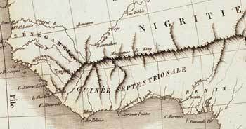
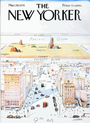
“The parody has been parodied many times, but the best modern parallel, and certainly the rudest, is to be found in the work of the much travelled Bulgarian graphic designer Yanko Tsvetkov. Tsvetkov, who works under the name Alphadesigner, may well have constructed the most offensive and cynical atlas in the world, all of it stereotypical, some of it funny. His Mercator projection entitled The World According to Americans showed a Russia labelled simply ‘Commies’, and a Canada labelled ‘Vegetarians’. He has also produced the Ultimate Bigot’s Supersize Calendar of the World, which includes Europe According to the Greeks. In this one, the bulk of European citizens live in the ‘Union of Stingy Workaholics’, while the UK is categorised as ‘George Michael’.”
1,148 reviews39 followers
December 13, 2012
This fascinating geographical look at our world is completely enthralling, and which takes you on the most exciting, remarkable journey!


This beautiful book is something to treasure, and which will delight fans of Geography, fine art and those who wish to explore the world and study different continents and countries. This book explores our loves for maps and for looking at the world, and which many readers including myself will find not only fascinating and enchanting but something that is to treasure for all-time! I personally connected to this book as my own Grandmother (who was an artist) drew the maps during World War two for Sir Winston Churchill, so as they could locate where to bomb Germany and so this brought to me a real sense of nostalgia and significance that touched my heart. I also love drawing by hand my own maps which I have done for art and for Geography studies, as someone who finds the world we live in absolutely fascinating and who like Sir David Attenborough wishes to explore and delve deeper beneath the surface – as there is so much too see and so much to know! This book may have connected with me on a personal and intimate level, but I also loved it for a great piece of narrative and something highly enjoyable to read. What Simon Garfield has to say is truly fascinating, extraordinary and which gives the reader such an insight as you will have never experienced before…

It is true that maps fascinate us, and that they not only chart our understanding of the world and log our progress but also above all they tell our stories. From the early sketches of Philosophers and explorers, to Google Maps and beyond, Simon Garfield examines how maps relate to our history (i.e. for example during wars or going further back in time when explorers visited uninhabited Islands or distant, remote places of the world!).
His compelling narratives range from the quest to creating the perfect ‘globe’ and to the challenges of mapping Africa and Antarctica, , from spellbinding treasure maps to the naming of America, from Ordnance Survey to the mapping of Monopoly and Skyrim, and from rare map dealers to cartographic frauds. (I must admit getting excited about the Pirate treasure maps!!). En route, there are 'pocket map' tales on dragons and undergrounds, a nineteenth century murder map, the research conducted on the different ways that men and women approach a map, and an explanation of the curious long-term cartographic role played by animals. On The Map is a witty and irrepressible examination of where we've been, how we got there and where we're going.

This book is so exciting and which covers every kind of map you can possibly think of, used in both real life, Middle-Earth, Pirates and great World Wars to explorers from time gone by; this really is the most comprehensive and wide-ranging guide I have ever encountered. Delightful and mesmerizing, one can sense the author’s enthusiasm and passion for his subject through the pages and which captures your attention instantly so that you are drawn into the book, which I can only compare to say when David Attenborough is talking about an exotic animal televised and you are instantly pulled into what he is saying for his fervor is infectious! Completely enthralling to all, whether you are looking at an Ordinance Survey or a map of London, one is simply enchanted by this beautiful book that twinkles with the delight of discovery.

If you are traveling or journeying abroad then this book is a must-have companion, as it takes one on a fascinating voyage of discovery, which ultimately heightens ones exciting experiences when we travel to somewhere. This is a brilliant book and one that I highly recommend to any budding expeditionary!
Profile Image for Peter Tillman.
4,014 reviews465 followers
April 25, 2022
I didn't like this one as much as I was expecting, largely because the graphics were god-awful -- time after time, the author would be talking about an old map, and there would be a half-page illustration that was utterly unreadable. I suppose that was on his publisher, and too small a budget to allow actual plates. Pity.

There are certainly some gems here. Such as Robert Louis Stevenson, of "Treasure Island" fame. He came from a family of marine engineers, specializing in building lighthouses -- and that's what he was trained to do, but his health was too fragile for the job. There's a great anecdote about his Grandfather, who designed and built the monumental Bell Rock lighthouse off Arbroath in 1810. His grandpa made a map of the vicinity, naming 70 features after friends, co-workers -- and also a series of treacherous rocks named after meddlesome lawyers and bureaucrats!

Then there was the strange case of the Mountains of Kong in West Africa, which appeared on a map published in 1798, based on misreading an explorer's report. The Mountains of Kong continued to appear on various maps until 1889, when a French geographer explored the course of the Niger River from Bamako (in present-day Mali) to the coast. He found nothing at the mapped location of these mountains, not even a range of hills.

I read this because of Dana Stabenow's enthusiastic review at https://www.goodreads.com/review/show... But now I see a number of less-enthusiastic reviews too. While I don't regret reading it, I'm not strongly recommending that you do so.
Profile Image for Elentarri.
1,997 reviews62 followers
January 16, 2025
Rating: ★★★⯪☆

This book is something of a cabinet of curiosities dedicated to the physical object of maps - from the Ancient Greeks to Google Earth. Each chapter covers a particularly historically important or notable map. The author has a droll and conversational writing style, but the poorly reproduced black and white graphics and lack of colour plates detract from the reading experience. The book is interesting but I felt that it tended to get tedious towards the middle, and then got more interesting at the end with chapters on GPS, brain mapping and the development of Google Earth.
Profile Image for Craig.
77 reviews27 followers
November 21, 2022
A superficial and error-ridden miscellany of maps and map-related matters. It's sometimes genuinely interesting, especially early on in the history of cartography, and the book is certainly ambitious in its way, though this can be more of a bug than a feature; by the end, as Garfield turns to "mapping" the brain and rambling about satnav etc., we're torturing cartographic metaphors more than talking about maps, and the collection starts to seem aimless and overlong.
261 reviews7 followers
October 12, 2012
Confident and fascinating history of the production and uses of maps.

FraMauroMap

Maps in the Great Library of Alexandria. The subsequent cartographic Dark Age. Why the Americas were named after a man who arrived a year after Columbus. How demographic maps were used to fight disease epidemics.

The final part considers if the cliche that there are sex differences in navigation has any basis in fact. Perhaps the abridger took a shortcut, but I fear that studies of rats and just so stories about presumed (hah!) prehistoric gender roles don't make a strong case either way. The rant against satellite-assisted navigation (quite possibly a fad) seems unnecessary.

I listened to an abridged audio adaptation.
Profile Image for Deb (Readerbuzz) Nance.
6,364 reviews336 followers
December 9, 2012
It probably doesn't surprise you that, in addition to being a book geek and a techno geek, I'm a map geek.

Are you a map geek, too?

If you are, then this book is for you. Every story out there with a map subtext is here. Treasure maps. Maps from Lewis & Clark. Map thieves. The story of GPS.

Read it. Even if you are just a little bit map geek-y. It makes for fascinating reading.
Profile Image for Kara Babcock.
2,091 reviews1,569 followers
August 19, 2014
This is the second map book I’ve read recently, the other being A History of the World in Twelve Maps . These two books are similar enough that I could spend the entire review comparing them, but I’d rather not do that. So let me make the comparison now and then move on: On the Map is neither as detailled nor, for me at least, as satisfying as A History of the World in Twelve Maps (or H12M, as I’ll call it from now on). Simon Garfield covers very similar territory less thoroughly. I’ll give him some points for style, but otherwise, H12M is the far surperior choice for people interested in history, maps, or the history of maps.

Where the two books diverge is probably in their audience: On the Map is ostensibly more about maps, with history as a backdrop to the story of cartography; H12M is more about history told through maps. So there’s that. But this is not good for On the Map, because I found that H12M often exceeded it in terms of the detail it goes into about the development and creation of maps.

I was thinking about how I read and remember non-fiction books while reading this. It has been over a year since I read H12M. I don’t remember much about it. My memory sucks. Why did I bother to read the book at all if I don’t remember anything that I learned from it? And if I’m not going to remember much from a book, why should I care if it is detailled or not?

Well, hopefully I did learn something from it, and it will bubble to the surface of my mind at the appropriate moment at a cocktail party where I can regurgitate it and look smarter than I am. And when that happens, it’s the details I recall. While reading about the Cassini project to map France or the acquisition of the Waldesemuller map in this book, I recalled Brotton’s discussions in H12M—I even went so far as to pull the book from my shelf and glance over those sections again.

So when I read non-fiction (and this is where I’ll stop comparing On the Map to H12M, I promise), I need little details that will get stuck in my brain like burrs. I’ll feel the itch but won’t necessarily know they are present until they resurface. Unfortunately, Garfield’s surface-treatment makes it harder for those burrs to form.

He’s at his best when discussing individuals, and particularly contemporary individuals he can interview himself. His journalist credentials are obviously on display when he discusses how he tracked down and met with an obscure person in the maps world. And those chapters are lovely. They don’t always stick to maps per se as the topic of discussion, but they show, as Garfield probably intends, the human element of mapmaking. Garfield successfully chronicles the way that mapmaking has mirrored the political and philosophical differences throughout history.

Some of my favourite chapters discuss how people relate to maps. Chapter 8 chronicles the rise of the atlas, and Chapter 16 talks about the evolution of guidebooks. Garfield goes beyond the nitty-gritty of how these maps were produced and talks more about the business and economics behind the mapmaking. I enjoyed reading about how the public seized upon maps as a new way of seeing their world (these days, who doesn’t check out their house on Google Street View?). And the idea that guidebooks revolutionized travel across a newly-industrialized Europe, especially for single women, was very interesting. It puts into perspective the literature of the time that I love to read.

In later chapters, Garfield goes on to address the rise of digital mapmaking. I wish he had done more with this: he pretty much just says, “it exists, and here’s how GPS works” but doesn’t go much deeper than that. He doesn’t talk too much about the surveillance implications of mapmaking. He doesn’t talk much about geocaching. He seems more interested in chronicling the rise of the various GPS and satnav firms, who bought whom, etc. For some people I’m sure this is very fascinating, but it wasn’t quite what I was looking for, and it didn’t match the human element that Garfield elucidates in previous chapters.

On the Map is a very uneven book. At times it is sumptuous in its discussion of maps and mapmaking. At times it is disappointing in the directions that Garfield pursues—some of these are a matter of taste, some are a matter of style. It’s not my favourite map book, but I’d recommend it if all you want is a sporadic discussion of mapmaking.

Creative Commons BY-NC License
Profile Image for Rossdavidh.
574 reviews208 followers
November 17, 2020
So, are maps obsolete, or are they more everpresent now than ever before? It is a bit of a semantics question, but it hangs over this book from the beginning to the end. Because before you can answer the question of when the first maps were made, or how much they are used today, you have to answer the question of what exactly you mean when you say 'map'.

Obviously, we do not normally mean "some lines drawn in the dust as part of a conversation" when we say "map", but it is plausibly argued that the ability to do that, was a major leap in human thinking, and it was the ability to think in maps. It is not the only way to transfer information about where things are, in relation to one another, but it is a uniquely useful one. It conveys information about more than just locations, of course; Garfield points out to us that early maps tended to have Jerusalem as "up", rather than north, and this is also conveying a piece of information (obviously Christian in origin) about what was important. The stone Xian "Map of China and Barbarian Lands", on the other hand, placed China at the center of the world.

Simon Garfield does a good job of weaving storytelling into the history of maps. He spends a good deal of time on the medieval Mappa Mundi of Hereford cathedral, both how it came to be and how it came to be offered up for auction in the 20th century. We discuss the immortal Mercator, and his mapmaking method of projecting a globe onto a flat surface (if you only know one map of the world, this is the one you know). We examine the shadowy world of ancient map selling, and sometimes thievery, occasionally by the same people. We look at whether Amerigo Vespucci deserves to have half the world named after him. We look at the famous cholera map of the 19th century, the mapping of Africa, Antarctica, and other remote (to Europe) places, and eventually even the arrival of satellite-based mapping that led to utterly nice and accurate maps of nearly any spot on the world. And then, we keep going.

Maps in the movies ("Casablanca"), maps in books (Middle Earth and Harry Potter), and eventually maps that never actually get made in paper even once. We can play a video game, and virtually move around on the map. Google maps has led to an explosion of mashups, in which you can express the spread of disease, human rights violations, wildlife sightings, house prices, and almost anything else by showing it on a map, on a screen, and then that map can change on a regular basis. We probably use the paper versions of the thing less often than in the 20th century, but we are probably looking at a map more often today than at any point in human history.

Myself, I am partial to paper maps, but I admit that I use the electronic kind more for getting around. I think, perhaps, it is the case that I use paper maps for something different than getting around; I use paper maps to help hold the entire set of relations and placenames in my mind at once, like writing something down in order to help remember it. Seen this way, paper and electronic maps may not even be competing media, but rather complementary.

Needless to say, if you aren't really interested in maps, you may or may not find this to be the book for you. I admit, this is not the first book on maps I've read (https://www.goodreads.com/book/show/1...). But beyond sheer map geekery, there is also the story of how humanity came to understand, and try to wrap our minds around, the world and our place in it.
Profile Image for Olga Godim.
Author 12 books84 followers
February 9, 2013
This is a fascinating book. Garfield obviously loves maps, and his map-infatuation is contagious. He rhapsodizes on the history of maps and their beauty, the people who created maps and the people who used them. Explorers and monks, scientists and artists, sailors and doctors – they all found their places on the pages of this book.
From ancient Greece to Google, maps have been a part of human life, and the author traces the evolution of the world maps through the centuries and around the globe. In addition to the mass of meticulously researched but slightly dry facts, he includes plenty of engaging stories in his chapters. The book is ripe with those stories. One of the more fascinating tales involves the reason why America is not called Columbus. Some stories are about the creation of famous maps, while others are anecdotes, tales of human gullibility, or accounts of extreme courage. Some are tragic while the others are whimsical or hilarious. Let’s take a look.
After the amazingly precise maps of the ancients, the most famous being Ptolemy’s map, Europe experienced a decline in cartography. For the next more than 1,000 years, the world maps produced in Europe were mostly mappa mundi. Some of them survived to this day. Usually, such medieval maps centered on Jerusalem. They had nothing to do with geography and everything to do with the religious view of the world – in pictures and words. Morality tales in visual form, they were frequently filled with interesting-looking beasts of the creators’ imagination. One of those beasts was Bonacon – a ram-like creature, shooting its ordure at its enemies as a defense mechanism. A charming species, to be sure. Of course, those maps were not intended for travel but were rather philosophical statements of the time.
Then, when the great journeys of Columbus and the rest of that bunch took place, Ptolemy’s map became popular once again, and serious cartography rose in prominence. There is a myth that Columbus himself had a copy of Ptolemy’s map with him, when he sailed for India and discovered America instead. Talk about the reliability of old maps! Or mapmakers.
The first Atlas and the history of travel guides, the city maps and the original British Ordnance Surveys (where even toilets could be found) – the enormous upload of information in this book is overwhelming. Names, dates, and places abound, but the numerous amusing interludes, sprinkled though the book, make it supremely entertaining as well as educational.
Did you know that on the world maps, California was an island for two centuries, starting from 1622? Last time it appeared as an island in 1865 on a map produced in Japan.
Another interesting tidbit: the legendary Mountains of Kong – the invented, impassable mountain range that crossed Africa west-east on the maps from 1798 on for almost a century.
Or how about this morsel: for one Middle Ages pilgrim, it took 230 changes of donkeys to get from Bordeaux to Constantinople. Of course, the man recorded his travels for posterity.
From geographical maps, the author proceeds to imaginary maps and treasure maps. There was an industry of treasure maps blooming in the middle of the 20th century. For $10, one could buy an Atlas of Treasure Maps, filled with sunken ships and buried pirate treasures, authenticity guaranteed.
While some of the maps were frivolous or outright silly, others were almost heroic. Did you know that during the WWII, the Monopoly makers secreted high-resolution maps of several European countries underneath the game boards in a few special sets? Red Cross then sent those game sets to Nazi’s concentration camps in Europe, attention of the military POWs. Some of those maps helped the captives escape.
And then there were medical maps, drafted by doctors. One of them – a map of the cholera outbreak in London in the middle of the 19th century – eventually led to the construction of London sewers
Garfield also mentions game maps (think D&D or Skyrim) and fantasy book maps, brain mapping and the reviving business of globe making. He discusses the power and potential for disaster associated with the new digital maps – Google, GPS and the like. What will happen, if all the GPS units stop working, he wonders? Or start working incorrectly? Mind boggles at the thought. Will we all drive into the ocean?
The book is engrossing and informative, written in a clear, precise language, and peppered with humorous asides. It includes lots of enthralling illustrations. Highly recommended for anyone – a map enthusiast or not.

Profile Image for Bettie.
9,981 reviews6 followers
March 6, 2014
BOTW

Listen here: http://www.bbc.co.uk/iplayer/episode/...

Simon Garfield starts his journey through the story of maps in the Great Library of Alexandria where, for the first time, scholars began to plot the wider world.

Ptolemy's atlas of AD 150 was to provide a template of the world for more than a thousand years and it was a version of this that Columbus took with him when he set sail for Japan in 1492.

Producer: Clive Brill A Pacificus production for BBC Radio 4.

#1 - All Facebook, Google and human contact maps. Dawkins.

#2 - After the brilliant theories of Alexandria, the world appeared to fall into a cartographic dark age for about a thousand years.

#3 - Simon Garfield's journey through the world of maps investigates why America was named after a man who got there a year after Christopher Columbus.

#4 - Simon Garfield's journey through the world of maps shows how the plotting of a special map of London led a Victorian doctor to the source of cholera and enabled him to conquer it.

#5 - Is it true that women are less good at navigating than men - or do they just have different ways of finding their bearings? Simon Garfield concludes his journey through maps.
223 reviews24 followers
March 26, 2014
Garfield has an eye for the clever and interesting aspects of what many might consider a dull subject and takes a wider view of cartography than many. Even people not enamored of maps will probably find something interesting here.
Profile Image for MaggyGray.
666 reviews31 followers
November 20, 2017
Da hat sich der Autor aber echt Mühe gegeben und unzählige Dinge recherchiert. Dachte ich Anfangs noch, es ginge tatsächlich vor allem um geologische Karten - und für den Hauptteil des Buches trifft das auch zu - aber es werden auch Karten ganz anderer Natur vorgestellt. So zum Beispiel die "Geisterkarte", die die Choleratoten in London kartierten und so eine Eindämmung der Krankheit herbeiführen konnte. Oder eine Gehirnkarte, die die einzelnen Regionen des Kopfes markiert, wie sie vor einigen Jahren von esoterisch angehauchten Quacksalbern benutzt wurden. Die berühmte Karte der Londoner U-Bahn und ein sehr interessantes Kapitel darüber, ob Frauen tatsächlich keine Karten lesen können.
Ein tolle Karten-Sammelsurium, das mich sehr gut unterhalten hat. Schön!
Profile Image for Pink.
537 reviews590 followers
May 15, 2014
This is a very interesting book and covers maps from old to new. It charts the discoveries of America, Australia and Antarctica as they were explored and looks at the power map makers, who changed with the discovering nations. The book then looks at more complex local maps, the advent of Ordnance Survey and A-Z street maps. It explores tube maps, brain maps, computer game mapping and GPS systems. It looks at our obsession with maps and how our lives are ruled by them, whether we know it or not.

I love maps and use them all the time.

Travelling to another country? I'll explore with google maps and make an itinerary.

Taking my son to a football match? I'll dig out the Sat Nav.

Tube closed while visiting London? I've got a street map for that. Or a maps app on my phone.

Lord of the Rings? Map poster on the wall.

Game of Thrones? A pull out map of Westeros for me to consult while reading.

There are many map books out at the moment and I've flicked through some of them, but they are often heavy on words and sparse on pictures. Which doesn't make sense when talking about such a visual device as maps. This book has plenty of pictures of plenty of maps. They are big enough to see properly, but my only gripe is that they are all black and white and many of these maps deserved to be seen in colour.

If you want a good introduction into maps, their history and their uses, then this is probably the book for you.


Profile Image for Manray9.
390 reviews118 followers
December 28, 2019
Simon Garfield’s On the Map was disappointing. Each chapter is an individual essay on an aspect of maps or the history of cartography – some instructive, some superficial, and some trite. Another Goodreads reviewer hit the right note in saying Garfield was channeling Bill Bryson, only Garfield isn’t funny. My overall assessment of On the Map is as a work too cute by half. I expected more.
Profile Image for Donovan Mattole.
390 reviews21 followers
January 9, 2013
I'm an old map enthusiast and have been in love with maps and cartography since I was a small boy. By the time I left for college the ceiling and loft in my room were so covered with National Geographic maps that you couldn't see the walls and I would study them and dream of traveling the world. Each month when the National Geographic arrived the first thing I would do is take out the map and spend an hour or two reviewing it. Today antique map shops are at an even higher level than used bookstores for me (and that is saying a lot) and I seek them out when traveling. I never leave without dropping a few hundred on an old map. In this book I realized that I'm actually a small time enthusiast and serious map collectors spend thousands and thousands...wow...so much more out there and now I have a plan on what I want to start looking for.

I expected this to just be about old maps, but Simon covers the entire spectrum of how maps have shaped our world, from the first maps in antiquity to treasure maps to fantasy maps (think Peter Pan or The Hobbit) to mapping Mars to the GPS system in our phones. The book is packed with history, intrigue and unique tidbits about mapmakers, history and how maps have influenced thinking and our worldview.

I loved this book and would recommend it to everyone who enjoys non-fiction, history or maps. You won't be disappointed.

Profile Image for Blue.
1,186 reviews54 followers
December 22, 2012
Thank you Goodreads and Gotham for the advance readers copy!

Mapping the moral Christian's journey, mapping the Facebook connections around the world, mapping the brain, mapping you as the dot walking across Central Park, mapping Mars, mapping the poles, mapping disease and poverty, mapping for fun, as satire, as a political statement... Garfield sets out from the beginnings of mapping and explores nearly all aspects of this pictorial depiction of surroundings and imagined places, from triangulation to map collecting. He writes about gallant explorers, a California that drifts away now and then, doomed voyages, misnamed continents, and perhaps most interestingly, map enthusiasts who, one way or another, made their mark in the way we draw and see the world. From cave drawings to atlases to globes, Garfield seems to cover great distances seamlessly. In a way, his book is also "travel by map," similar to the little plane leading a dotted line in Hollywood films, except the book travels through space, time, and perhaps other [imagined] dimensions.

Recommended for those who like maps, travel, and history.
Profile Image for Mike Silverman.
4 reviews5 followers
December 4, 2012
"On the Map" is a wonderful, rambling tour through the world of maps, focusing on major events in mapmaking history as well as the various social and cultural functions maps have played over time. Like any good journey, the book is filled with lots of side-trips covering topics such as the development of travel guidebooks, the role of the modern GPS, and maps of hidden treasures. Each major chapter is followed by a "mini-chapter" covering bits of map-making trivia. The book is also well-illustrated - if the author talks about a map, there's probably an image of it nearby - this isn't a picture-book, but there are enough images that you don't run screaming with frustration to Google every other page to actually see the map under discussion. The writing style is breezy and well-informed, with bits of humor scattered throughout. For anyone already interested in maps, this is a must-read (although an expert or specialist will find much of the material stuff they already know). For the curious reader who is not already a map-head - they too will enjoy the book due to the accessible style of the writing. Highly recommended.
Profile Image for Stuart.
Author 88 books3,597 followers
February 12, 2013
The early parts of this book are quite interesting, exploring the history of maps, although it seemed to me that there were some serious gaps in the story. Garfield points out that maps didn't change for hundreds of years -- and then they did -- without really explaining why they changed so suddenly. He also seems to be trying to be funny much of the time, like he's attempting to channel Bill Bryson, which is a shame, because he's nowhere near as funny as Bryson. Bryson makes me laugh. Garfield doesn't. And finally, the book comes off the rails a few times in later chapters, as it enters the modern era, especially in the pointless chapter about maps in movies, where Garfield eventually veers into maps of the movie stars homes for no reason. He's also surprisingly crotchety about GPS, sounding like an old crank when he wonders why anyone would ever use it rather than a map. I love maps, but I can see the advantages of GPS. You'd think someone who spent a few years researching maps might give the future of them a bit more thought.
Profile Image for Paul.
2,217 reviews
September 4, 2013
Maps can be a source of wonder to those that like to explore the world, or bring a sense of bewilderment to those that are directionally challenged. Garfield brings his sense of wonder to this subject

In his engaging style, he write about all aspects of maps, from the earliest know maps, a new producer of globes, sat navs, folding maps and how women can read maps; but not those created by men!

I liked the way he has done mini chapters for subjects that do not justify a full chapter, but really cannot be lumped in with other subjects. He travels all over the world, meeting map sellers, globe producers, and the head of Google Earth who is probably the man best place to sculpt the future of maps in years to come.

It has enough details to captivate the reader, but not so many to make it a academic tome.
Profile Image for Dan.
232 reviews172 followers
March 16, 2013
This book was everything I had hoped Maphead to be. Where that book focused on the people who love maps, this book focused on the maps themselves, and I enjoyed it all the more for that reason. It also had pictures of the maps actually printed in the book itself! What a thought!

The book goes chronologically from past to present, starting with Greeks and Romans, continuing through the Dark Ages, Renaissance, spends quite a bit of time in the New World before settling on modern life, finishing up with Skyrim and Google Maps. While I'm more of a historical map buff, and the last few chapters weren't as interesting, the book was engaging from start to finish, and it was an excellent choice.

Highly recommending to map loves of any age or inclination; lots of fun history included for free!
Profile Image for Kelly Sedinger.
Author 6 books24 followers
January 7, 2018
What a fascinating book this is! It's a history not just of mapmaking but of the world of maps in general: mapmakers, map printers, globe makers, map collectors, and there are even chapters on the use of maps in fiction (such as Tolkien), in games, and what the digital/GPS era means for the future of maps and mapmaking. And then there are the asides that delve briefly into issues regarding specific maps or well-known figures in mapmaking, such as the origins of gerrymandering, a "murder map" made in conjunction with an awful crime in England in the early nineteenth century, and a treasure map that literally led to buried treasure in the famous book "Masquerade".

This is the kind of book that rewards one's curiosity, and indeed reminds one that the world is still full of wonderful things to be curious about. What a great start to my 2018 reading!
Profile Image for Kathryn Bashaar.
Author 2 books107 followers
July 21, 2013
I didn't like this book as much as I thought I would. I LOVE maps, and this book is about maps, so I thought I'd just love it. It gives a little history of maps, and lots of anecdotes about maps. It was interesting, but it didn't seem to cohere into a theme, and I'm the kind of person who likes things to all make sense and be tied up tidily. I know that's not very realistic, but I like things to make sense and that's probably why I like maps so much.
Profile Image for JaumeMuntane.
450 reviews13 followers
October 19, 2016
4'5/5

Cita ineludible con un fascinante, ameno e interesante recorrido por la historia de los mapas. Si, como yo, te fascinan los mapas y la historia, disfrutarás de este divulgativo ensayo.
Profile Image for Barb in Maryland.
2,079 reviews173 followers
March 15, 2019
Very enjoyable. The first third of the book will be familiar to anyone who has read any history of maps and map-making. But then the author started heading off into unfamiliar territory--oversize atlases, Churchill's globe and map room, mapping the brain, and so on. Published in 2013, it ends with Google Earth and GPS.
The author has an engaging voice; the tone is not scholarly; the target audience is map enthusiasts.
I can't believe I let this stagnate in my TBR for 6 years!
Profile Image for Joana.
916 reviews18 followers
July 21, 2023
Quite a comprehensive overview of maps: from their evolution and history, to their applications and significance. It also goes beyond traditional maps, to include maps from fiction, games, digital and artful ones. It was interesting but definitely not something I'd read for very long periods, rather a little every day.
Displaying 1 - 30 of 571 reviews

Can't find what you're looking for?

Get help and learn more about the design.